Marine heatwaves along the coast of Western Australia, referred to as Ningaloo Niño, have had dramatic impacts on seaweed and seagrass beds over the past decade with potential knock on effect to populations of undersize lobster.
The Western Rock Lobster Council (WRL) in conjunction with the Department of Primary Industries and Regional Development (DPIRD) have developed a new standardised survey to provide an index of undersize lobsters at 12 locations throughout the fishery.
This Independent Shallow Water Survey (ISS) was designed to investigate nearshore areas of low catch that have been reported within historically good shallow fishing grounds.
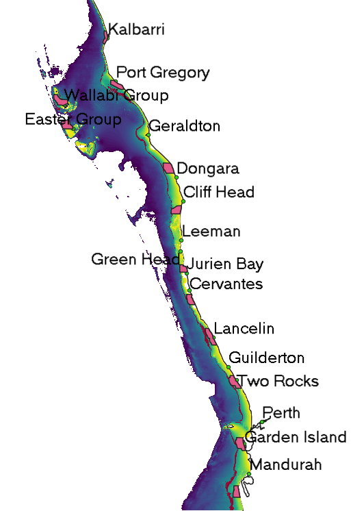
It is thought the marine heat wave of 2011, driven by a Ningaloo Niño event and unusually strong Leeuwin Current, was responsible for the loss of habitats at key locations, including Kalbarri and Dongara.
To complement the ISS survey the Western Rock Lobster Industry’s Partnership Agreement with the Fisheries Research and Development Corporation (FRDC), has funded a study to investigate the use of satellite imagery to assess and track changes in coastal marine habitats and establish a monitoring program across the West Coast Rock Lobster Managed Fishery.
Dr Stanely Mastrantonis and Dr Sharyn Hickey from the University of Western Australia in collaboration with the Indian Ocean Marine Research Centre’s ICoAST program are working to analyse this imagery.
“The most important thing for us to do is ground truth the satellite imagery, and that is where working with experienced fishers has proved invaluable,” said Dr Mastrantonis.
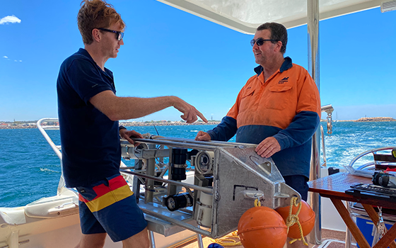
John Fitzhardinge, boat builder and fisherman for over 40 years, designed a new panoramic underwater camera system for the project.
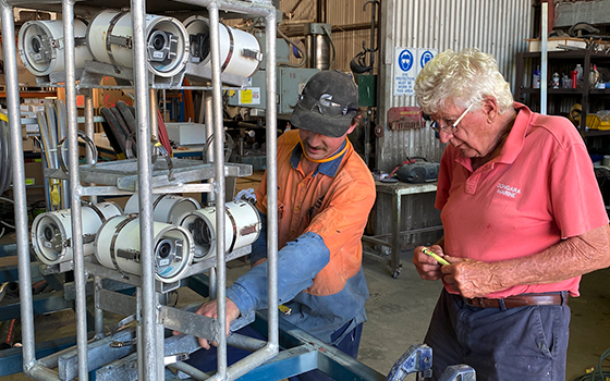
Now John and the team are working in collaboration with fishers and DPIRD to collect imagery throughout the fishery using this camera system.
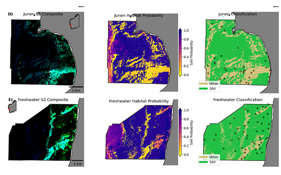
Stanley has now developed a new spectral analysis to convert composite satellite imagery into an index of Submerged Aquatic Vegetation (SAV), that is performing well to map and track change in habitats across the ISS locations.
The next steps in the project are to integrate historical satellite images to map how habitats have changed over time and devise a cost-effective way that the monitoring of recruitment habitat extent can be integrated into monitoring programs across the West Coast Rock Lobster Managed Fishery.
